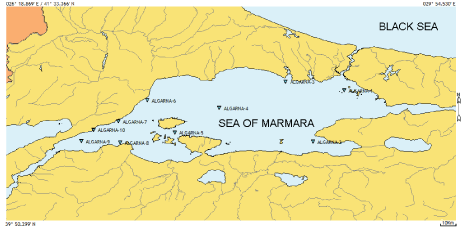
Figure 1: Survey area map of the MAREM (Marmara Environmental Monitoring) project, showing the 10 fixed beam-trawl sampling stations (▼) for each year.

M Levent Artüz1 O Bülent Artüz1 Mehmet Sakınç2 Bahattin Yalçın3* B Eygi Erdoğan4
1Sevinç-Erdal İnönü Foundation, MAREM (Marmara Environmental Monitoring Project) Department of Marine Sciences, Anadoluhisarı Toplarönü, Istanbul, Turkey.*Corresponding author: Bahattin Yalçın, Department of Chemistry, Faculty of Science and Arts, Marmara University, Göztepe, 34722 Istanbul, Turkey, E-mail: byalcin@marmara.edu.tr
The aim of this study is to try to prove the hypothesis that “When species diversity reduced, the survived unit members in the environment would be increased”, which named by us as “Pessimum conditions rule” in the scale of the Sea of Marmara.
To prove the hypothesis “Pessimum conditions rule”, data from 604 observations both of benthic and oceanographically stations gathered in a 7-year period (2006-2012) were analyzed and compared, and the results used to show the relationship between classic biotic descriptors (e.g. number of species, number of individuals, richness index, dominance index, Shannon/Menhinick diversities) and environmental variables (e.g. Dissolved Oxygen, temperature, Salinity, pH) and depth. Multiple analysis of covariance and multiple linear regressions were used for the statistical analysis of the data.
Correlations between benthic community indices and water quality variables showed that generally might affect community diversity. Besides this, it is clear that variation within benthic habitats in the Sea of Marmara cannot be explained by a single factor, such as uncontrolled overfishing and the revolving changes in the adjacent connected seas or driven by biotic interactions rather than by the water quality.
According to the sample composition of benthic catches and related frequency values, a relative increase in the number of individuals was observed. This is also apparent by the correlation between basic pollution parameters and the community index values regarding long-term data of the present work.
The measured values of the constant environment, created due to the unique structure of the Mediterranean originated lower layer of the Sea of Marmara, and correlated biotic parameters were showing a coherent dispersion in the completely sampling period. However, contrary to this, the values of the number of species were exactly the opposite. In the present study, pessimum conditions rule has been especially distinctive in the Sea of Marmara regarding the long-term data of the benthic catches.
Also, this work report on species composition of the benthic catches in the Sea of Marmara for an assessment of the status of these communities and relation these communities with pollution phenomenon.
Diversity; Fauna; New records; Dominance; Species richness; Pessimum rule; Long-term monitoring
Anthropogenic impact on marine life has escalated over the last semi centennial and threatened the balance of the ecosystem. Radical ecological changes in a sea can be provided most effectively by monitoring the benthic fauna, as most of the ecological impact and pollution load ultimately will end up on the seabed.
In an inland sea, such as the Sea of Marmara, especially the coastal urban areas are subject to unfavorable ecological changes mainly associated with eutrophication, oxygen deficiency, contaminants and overfishing. The unique water mass of Sea of Marmara has been strongly influenced by anthropogenic activities.
The entire system of Turkish Straits and Sea of Marmara extends from the Black Sea to the Aegean Sea through Bosporus (31 km), Sea of Marmara (210 km), and Dardanelles (60 km). The total length of the system is approximately 300 km, with a maximum depth of 1273 m. The maximum depth of the Sea of Marmara is controversial. The most accurate data are obtained by IFREMER [1] during earthquake studies, with a maximum of 1273 m.
Because of the combination of precipitation and runoff exceeds evaporation, relative low salinity and less dense water mass of the Black Sea is entirely different from those of the Mediterranean Sea originated saline and correspondingly dense water mass [2]. Due to the great differences in salinity-based density between the waters of the Black Sea and the Mediterranean Sea, there is a two-layered current system along the Turkish Straits and the Sea of Marmara, flowing in opposite directions [3]. In addition, there are serious vertical mixing points along those waterways especially in narrow and shallow straits and it tends to reduce the density of the deeper surface layer (approx. 200 m). Therefore, the deeper surface layer of the Sea of Marmara has a lower density than that of the water in the Aegean Sea at the equal depth [4].
As the connection between the Mediterranean Sea via Dardanelles and the Black Sea via Bosporus, the Sea of Marmara is a two-layered water mass with unique circumstances and attributes that determine its biological and ecological characteristics. The Sea of Marmara is situated between these two different ecosystems and serves as a sheltering, feeding and nesting area for both the Mediterranean Sea and the Black Sea originated forms, constituting a biological corridor [3].
Collectively, the two Straits and the Sea of Marmara provide an important “acclimatization zone” for transiting species during their migration from the Black Sea to the Aegean Sea and vice versa [5]. In addition, because of this, the increasing manner of Lessepsian invasion began to strongly affect to the Sea of Marmara as a result of decreased competition due to the reduction in species diversity [6].
The first benthic study on the Sea of Marmara was carried out by Ostroumoff, et al. [7,8]. Following benthic and biological studies were by Marion (1898), Demir (1954), Tortonese (1959), Caspers (1968), Ünsal (1988), Balkıs (1992), Eryılmaz (1997), Uysal et al., (2002), Artüz et al., (2007, 2008, 2009,2011a, 2011b, 2012, 2013) [3,4,9-21]. In addition to benthic studies, there were some specific works that partly discussed the benthic fauna of the Sea of Marmara and Turkish Strait System [22-31]. Biodiversity studies were very limited and inadequate for studying this unique water mass, which was considered as a passageway or biological corridor.
Over the years, the Sea of Marmara has been under pressure in terms of pollution from domestic and industrial wastewater sources. Therefore, water quality has degraded significantly and biodiversity has been compromised in the Sea of Marmara. The current study presents literality of the pollution-based theory “When species diversity reduced, the survived unit members in the environment would be increased” for Sea of Marmara, that first proposed by Artüz, et al, 2007 regarding long-term data between years 2006 and 2012.
In this study, Sea of Marmara is particularly selected as an appropriate model to test the “Pessimum conditions rule” because of providing the following conditions; i) presence of long-term and regular benthic and chemical-physical oceanographic data; ii) the sub-thermocline water mass carrying the Mediterranean water mass properties, particularly; iii) is relatively small in size and easily controllable in terms of pollution parameters; iv) as a suitable model for testing the hypothesis that species are biologically close to the Mediterranean in terms of diversity.
A series of samples were taken at annually at periodic intervals at same localities in Sea of Marmara from August 2006 to August 2012. The study was conducted at 61 stations (Figure 1) in the Sea of Marmara, between 15/08/2006 and 30/07/2012 (Table 1). Locations were determined by MAP 330GPS as part of the project MAREM (Marmara Environmental Monitoring Project) entitled, “Changing Oceanographic Conditions of the Sea of Marmara”, Istanbul.
Figure 1: Survey area map of the MAREM (Marmara Environmental Monitoring) project, showing the 10 fixed beam-trawl sampling stations (▼) for each year.
| Station Nº | Beginning coordinate | Ending coordinate | Depth (m) | Date |
| ALGARNA-1 | 40° 38.167' N : 027° 12.100' E | 40° 38.667' N : 027° 12.450' E | 23 | 15/08/2006 |
| ALGARNA-2 | 40° 36.067' N : 027° 10.750' E | 40° 36.000' N : 027° 10.183' E | 70 | 15/08/2006 |
| ALGARNA-3 | 40° 33.850' N : 027° 00.867' E | 40° 33.233' N : 027° 00.983' E | 15 | 15/08/2006 |
| ALGARNA-4 | 40° 27.500' N : 027° 13.050' E | 40° 27.667' N : 027° 12.333' E | 32 | 19/08/2006 |
| ALGARNA-5 | 40° 27.217' N : 027° 06.750' E | 40° 27.233' N : 027° 06.167' E | 35 | 19/08/2006 |
| ALGARNA-1 | 40° 52.583' N : 028° 59.650' E | 40° 52.750' N : 028° 59.833' E | 40 | 03/08/2007 |
| ALGARNA-2 | 40° 28.150' N : 028° 45.850' E | 40° 27.733' N : 028° 45.133' E | 60 | 03/08/2007 |
| ALGARNA-3 | 40° 56.650' N : 028° 33.517' E | 40° 56.617' N : 028° 33.100' E | 56 | 04/08/2007 |
| ALGARNA-4 | 40° 32.800' N : 027° 41.283' E | 40° 32.217' N : 027° 40.717' E | 50 | 05/08/2007 |
| ALGARNA-5 | 40° 56.150' N : 027° 37.583' E | 40° 56.133' N : 027° 38.567' E | 75 | 06/08/2007 |
| ALGARNA-6 | 40° 38.167' N : 027° 12.250' E | 40° 37.733' N : 027° 11.550' E | 45 | 07/08/2007 |
| ALGARNA-7 | 40° 32.917' N : 027° 12.500' E | 40° 32.733' N : 027° 13.000' E | 74 | 07/08/2007 |
| ALGARNA-8 | 40° 33.317' N : 027° 00.367' E | 40° 33.700' N : 027° 00.800' E | 33 | 09/08/2007 |
| ALGARNA-9 | 40° 27.017' N : 027° 13.200' E | 40° 27.067' N : 027° 13.900' E | 27 | 09/08/2007 |
| ALGARNA-10 | 40° 27.150' N : 027° 06.067' E | 40° 27.017' N : 027° 05.383' E | 40 | 09/08/2007 |
| ALGARNA-2 | 40° 28.700' N : 028° 45.683' E | 40° 28.267' N : 028° 45.950' E | 53 | 07/08/2008 |
| ALGARNA-3 | 40° 56.517' N : 028° 32.333' E | 40° 56.200' N : 028° 31.383' E | 56 | 08/08/2008 |
| ALGARNA-4 | 40° 32.417' N : 027° 41.317' E | 40° 32.583' N : 027° 40.300' E | 60 | 09/08/2008 |
| ALGARNA-5 | 40° 45.900' N : 027° 25.150' E | 40° 45.133' N : 027° 25.550' E | 650 | 11/08/2008 |
| ALGARNA-6 | 40° 44.300' N : 027° 26.150' E | 40° 44.067' N : 027° 26.833' E | 500 | 11/08/2008 |
| ALGARNA-8 | 40° 33.383' N : 027° 00.867' E | 40° 33.767' N : 027° 01.467' E | 26 | 12/08/2008 |
| ALGARNA-9 | 40° 27.000' N : 027° 12.600' E | 40° 26.867' N : 027° 11.867' E | 40 | 11/08/2008 |
| ALGARNA-10 | 40° 27.133' N : 027° 05.967' E | 40° 27.450' N : 027° 04.800' E | 39 | 11/08/2008 |
| ALGARNA-1 | 40° 52.217' N : 029° 00.100' E | 40° 51.633' N : 029° 00.950' E | 96 | 01/08/2009 |
| ALGARNA-2 | 40° 28.550' N : 028° 46.033' E | 40° 28.083' N : 028° 46.717' E | 59 | 04/08/2009 |
| ALGARNA-3 | 40° 57.150' N : 028° 32.567' E | 40° 57.267' N : 028° 31.717' E | 56 | 05/08/2009 |
| ALGARNA-4 | 40° 44.700' N : 027° 50.800' E | 40° 44.667' N : 027° 59.500' E | 950 | 06/08/2009 |
| ALGARNA-5 | 40° 32.400' N : 027° 40.767' E | 40° 31.917' N : 027° 40.167' E | 60 | 07/08/2009 |
| ALGARNA-6 | 40° 48.233' N : 027° 27.550' E | 40° 46.767' N : 027° 26.983' E | 1100 | 11/08/2009 |
| ALGARNA-7 | 40° 38.400' N : 027° 12.617' E | 40° 37.783' N : 027° 11.350' E | 28 | 12/08/2009 |
| ALGARNA-8 | 40° 27.250' N : 027° 13.417' E | 40° 26.650' N : 027° 11.800' E | 45 | 12/08/2009 |
| ALGARNA-9 | 40° 27.833' N : 026° 55.000' E | 40° 27.617' N : 026° 53.417' E | 43 | 12/08/2009 |
| ALGARNA-10 | 40° 33.333' N : 027° 00.500' E | 40° 33.717' N : 027° 01.133' E | 27 | 13/08/2009 |
| ALGARNA-1 | 40° 52.267' N : 029° 00.867' E | 40° 52.033' N : 029° 01.500' E | 81 | 08/08/2010 |
| ALGARNA-2 | 40° 27.517' N : 028° 45.900' E | 40° 26.850' N : 028° 45.967' E | 63 | 11/08/2010 |
| ALGARNA-3 | 40° 56.483' N : 028° 32.817' E | 40° 56.133' N : 028° 31.900' E | 64 | 12/08/2010 |
| ALGARNA-4 | 40° 43.800' N : 028° 00.967' E | 40° 43.667' N : 028° 01.783' E | 900 | 13/08/2010 |
| ALGARNA-5 | 40° 31.983' N : 027° 39.667' E | 40° 31.267' N : 027° 39.000' E | 58 | 13/08/2010 |
| ALGARNA-6 | 40° 47.483' N : 027° 26.450' E | 40° 47.600' N : 027° 27.117' E | 1100 | 15/08/2010 |
| ALGARNA-9 | 40° 27.767' N : 026° 54.900' E | 40° 27.800' N : 026° 54.150' E | 42 | 15/08/2010 |
| ALGARNA-7 | 40° 37.300' N : 027° 12.617' E | 40° 37.950' N : 027° 11.900' E | 30 | 15/08/2010 |
| ALGARNA-8 | 40° 27.217' N : 027° 13.533' E | 40° 27.083' N : 027° 11.867' E | 45 | 15/08/2010 |
| ALGARNA-10 | 40° 33.333' N : 027° 00.767' E | 40° 33.817' N : 027° 01.450' E | 22 | 16/08/2010 |
| ALGARNA-1 | 40° 52.483' N : 029° 00.267' E | 40° 53.033' N : 029° 01.183' E | 74 | 31/07/2011 |
| ALGARNA-2 | 40° 27.050' N : 028° 45.633' E | 40° 26.783' N : 028° 46.433' E | 65 | 02/08/2011 |
| ALGARNA-3 | 40° 58.417' N : 028° 07.483' E | 40° 58.467' N : 028° 06.517' E | 40 | 04/08/2011 |
| ALGARNA-4 | 40° 45.050' N : 027° 58.300' E | 40° 44.550' N : 027° 58.317' E | 900 | 05/08/2011 |
| ALGARNA-5 | 40° 33.467' N : 027° 43.450' E | 40° 33.183' N : 027° 42.533' E | 65 | 06/08/2011 |
| ALGARNA-6 | 40° 48.850' N : 027° 29.167' E | 40° 48.317' N : 027° 28.483' E | 1000 | 07/08/2011 |
| ALGARNA-7 | 40° 27.950' N : 027° 08.367' E | 40° 27.850' N : 027° 07.533' E | 32 | 08/08/2011 |
| ALGARNA-8 | 40° 26.467' N : 026° 50.067' E | 40° 26.767' N : 026° 50.800' E | 31 | 09/08/2011 |
| ALGARNA-9 | 40° 33.950' N : 027° 01.100' E | 40° 33.500' N : 027° 00.917' E | 23 | 09/08/2011 |
| ALGARNA-1 | 40° 52.500' N : 029° 00.333' E | 40° 52.067' N : 029° 01.117' E | 64 | 24/07/2012 |
| ALGARNA-2 | 40° 27.217' N : 028° 45.667' E | 40° 26.667' N : 028° 45.500' E | 65 | 26/07/2012 |
| ALGARNA-3 | 40° 57.450' N : 028° 31.617' E | 40° 57.617' N : 028° 30.400' E | 53 | 22/07/2012 |
| ALGARNA-4 | 40° 44.567' N : 028° 01.200' E | 40° 44.500' N : 028° 02.017' E | 1000 | 27/07/2012 |
| ALGARNA-5 | 40° 32.733' N : 027° 43.117' E | 40° 32.383' N : 027° 42.067' E | 64 | 28/07/2012 |
| ALGARNA-6 | 40° 49.400' N : 027° 29.133' E | 40° 50.583' N : 027° 29.333' E | 1000 | 21/07/2012 |
| ALGARNA-7 | 40° 27.800' N : 027° 07.183' E | 40° 27.017' N : 027° 05.917' E | 49 | 29/07/2012 |
| ALGARNA-8 | 40° 27.167' N : 026° 51.100' E | 40° 26.950' N : 026° 50.350' E | 30 | 29/07/2012 |
| ALGARNA-9 | 40° 33.533' N : 027° 00.650' E | 40° 33.850' N : 027° 01.283' E | 18 | 30/07/2012 |
Table 1: Location table with the beginning and ending coordinates of hauls, depth, and working date for each station.
A twin beam trawler ‘Oktay 4’ (length overall, 28 m; gross tonnage, 142 GT; main engine, 735 kW) was used for the study. The vessel was rigged for twin 3,75 m beam trawls with 18 and 3,6 mm stretched mesh sizes at the cod-ends. Hauls were conducted once at each station with a quarter-hour duration and boat speed of 2 mph.
All captured material was retained for species identification, and then each species was weighed (wet weight) to the nearest 0,01 g and the number of individuals from each species was determined. Also, attached invertebrates on the captured various kind and sizes hard substrate are also collected and added to catch composition.
Thereafter, the collected species were fixed in 10% buffered formalin-seawater and then were taken to the laboratory for closer examination. Samples were rinsed with formalin after about a week and transferred to 70% isopropyl alcohol.
Mainly the most abundant species was Spatangus purpureus and was hauled at some stations in large quantities, more than 4 MT in each haul. In this case, the number of individuals is calculated using a random sampling method with 25 replicates, and numbers of individuals are submitted as an average value. Also in station ALGARNA-2, on August 2008, the mass aggregates of Phyllochaetopterus socialis, with a total wet weight of 58 kg, are not counted in the individual basis and are not added to calculations.
Several catch parameters were estimated in this study: the species richness index according to the equation of the Shannon-Weiner index [32-36] and the evenness index according to Pielou, et al. [37]; the number of species and dominance index thereof Simpson, et al. [38]. In text and tables, the calculation results of indices are given as rounded upwards to two decimal places. Because of, values below the 0,01 were assigned as (:<e-2).
MANCOVA was performed (multiple analysis of covariance) to test if there is a significant difference in the centroid of the means of the multiple dependent variables for East and West regions of the Sea of Marmara. The reason for this distinction is the examination of pollution based apparent effect of the external factor on the distribution and diversity of species between the eastern region (Algarna 1; 2; 3) under heavy pollution load and the western region (Algarna 4; 5; 6; 7; 8; 9; 10) under relatively less pollution load which are in the same water mass.
The dependent variables were “the number of species (S)”, “the number of individuals (Nº)” and “dissolved oxygen (DO)” where the factor variable was “the region”. MANCOVA is a statistical method which allows using continuous control variables as covariates when dealing with analyses where there is more than one outcome variable explained by one or more independent variables. “The year” was used as the covariate to control the dependent variables’ values for the year they were collected.
A post-hoc comparison has also been performed, using Bonferroni adjustment [39] for multiple comparisons, to test the mean differences between East and West regions for each dependent variable individually. Statistical analyses were carried out using the Statistical Package for the Social Sciences (SPSS) version 20,0 (IBM SPSS Statistics for Windows, Version 20,0; IBM Corp., Armonk, New York, USA).
All oceanographical parameters were measured in situ with a CTD YSI 6600 V2 multi-parameter data sonde and MIDAS ECM along with the water column with 1 sec duration (approximately 10 cm intervals) from the surface (0,5 m) to the deepest section of the station. The mean values of the water mass of 1 m in height from the bottom are used in the calculations.
The analysis for the bottom type regarding Wenworth, et al. [40] was carried two replicates on the samples of gravity-corer from the upper 2 cm layer of sediment. Small Stones and shell parts were removed before drying and the residue of the first replicate was sieved on a mechanical shaker through six sieves (mesh size of 2 mm-0,004 mm) for 60 min, and the sediment present in each sieve was weighed. The second replicate was burned on 400 °C for the organic ingredient.
The basic bottom types (Sand: 2 mm to 0,59 mm; Silt: 0,6 mm to 0,004 mm; Clay: <0,004 mm; Muddy: mixture of sand+silt+clay; Detritus: ≥ 50% of the weight lost when burned) are given in Table 2.
| Stationrichness | Index values | ||||||||||||
| Station | Depth (m) | Bottom | S | Nº | DMg | DMn | H' | J' | |||||
| 2006 | |||||||||||||
| ALGARNA-1 | 23 | Silt/Clay | 10 | 166 | 1,76 | 0,78 | 1,91 | 0,83 | |||||
| ALGARNA-2 | 70 | Clay | 14 | 307 | 2,27 | 0,80 | 1,93 | 0,73 | |||||
| ALGARNA-3 | 15 | Detritus | 10 | 73 | 2,10 | 1,17 | 2,01 | 0,87 | |||||
| ALGARNA-4 | 32 | Detritus | 15 | 360 | 2,38 | 0,79 | 1,93 | 0,71 | |||||
| ALGARNA-5 | 35 | Silt | 17 | 159 | 3,16 | 1,35 | 2,63 | 0,93 | |||||
| 2007 | |||||||||||||
| ALGARNA-1 | 40 | Silt/Clay | 9 | 533 | 1,27 | 0,39 | 0,69 | 0,31 | |||||
| ALGARNA-2 | 60 | Clay | 25 | 1867 | 3,19 | 0,58 | 2,18 | 0,68 | |||||
| ALGARNA-3 | 56 | Detritus | 15 | 1266 | 1,96 | 0,42 | 1,28 | 0,47 | |||||
| ALGARNA-4 | 50 | Detritus | 25 | 369 | 4,06 | 1,30 | 2,93 | 0,91 | |||||
| ALGARNA-5 | 75 | Silt | 18 | 875 | 2,51 | 0,61 | 1,85 | 0,64 | |||||
| ALGARNA-6 | 45 | Muddy | 19 | 464 | 2,93 | 0,88 | 2,54 | 0,86 | |||||
| ALGARNA-7 | 74 | Sandy clay | 27 | 498 | 4,19 | 1,21 | 2,58 | 0,78 | |||||
| ALGARNA-8 | 33 | Sandy clay | 23 | 467 | 3,58 | 1,06 | 2,59 | 0,83 | |||||
| ALGARNA-9 | 27 | Silt/Clay | 28 | 491 | 4,36 | 1,26 | 2,80 | 0,84 | |||||
| ALGARNA-10 | 40 | Clayed sand | 27 | 810 | 3,88 | 0,95 | 2,46 | 0,75 | |||||
| 2008 | |||||||||||||
| ALGARNA-2* | 53 | Clay | 43 | 1872 | 5,57 | 0,99 | 1,99 | 0,53 | |||||
| ALGARNA-3 | 56 | Detritus | 22 | 1421 | 2,89 | 0,58 | 1,35 | 0,44 | |||||
| ALGARNA-4 | 60 | Detritus | 41 | 968 | 5,82 | 1,32 | 2,59 | 0,70 | |||||
| ALGARNA-5 | 650 | Silt | 1 | 16 | < e-2 | 0,25 | < e-2 | < e-2 | |||||
| ALGARNA-6 | 500 | Muddy | 4 | 3939 | 0,36 | 0,06 | 0,13 | 0,09 | |||||
| ALGARNA-8 | 26 | Sandy clay | 32 | 648 | 4,79 | 1,26 | 3,06 | 0,88 | |||||
| ALGARNA-9 | 40 | Silt/Clay | 19 | 213 | 3,36 | 1,30 | 2,63 | 0,89 | |||||
| ALGARNA-10 | 39 | Clayed sand | 28 | 2264 | 3,50 | 0,59 | 1,10 | 0,33 | |||||
| 2009 | |||||||||||||
| ALGARNA-1 | 96 | Silt/Clay | 13 | 6808 | 1,36 | 0,16 | 0,13 | 0,05 | |||||
| ALGARNA-2 | 59 | Clay | 22 | 658 | 3,24 | 0,86 | 1,85 | 0,60 | |||||
| ALGARNA-3 | 56 | Detritus | 19 | 132456 | 1,53 | 0,05 | 0,02 | 0,01 | |||||
| ALGARNA-4 | 950 | Muddy | 6 | 134 | 1,02 | 0,52 | 1,25 | 0,70 | |||||
| ALGARNA-5 | 60 | Silt | 36 | 556 | 5,54 | 1,53 | 2,65 | 0,74 | |||||
| ALGARNA-6 | 1100 | Muddy | 10 | 130 | 1,85 | 0,88 | 1,93 | 0,84 | |||||
| ALGARNA-7 | 28 | Sandy clay | 24 | 987 | 3,34 | 0,76 | 1,98 | 0,62 | |||||
| ALGARNA-8 | 45 | Sandy clay | 28 | 482 | 4,37 | 1,28 | 2,38 | 0,71 | |||||
| ALGARNA-9 | 43 | Silt/Clay | 61 | 1049 | 8,63 | 1,88 | 3,34 | 0,81 | |||||
| ALGARNA-10 | 27 | Clayed sand | 42 | 551 | 6,50 | 1,79 | 3,03 | 0,81 | |||||
| 2010 | |||||||||||||
| ALGARNA-1 | 81 | Silt/Clay | 10 | 21628 | 0,90 | 0,07 | 0,07 | 0,03 | |||||
| ALGARNA-2 | 63 | Clay | 23 | 115429 | 1,89 | 0,07 | 0,02 | 0,01 | |||||
| ALGARNA-3 | 64 | Detritus | 30 | 151457 | 2,43 | 0,08 | 0,05 | 0,01 | |||||
| ALGARNA-4 | 900 | Muddy | 10 | 212 | 1,68 | 0,69 | 1,41 | 0,61 | |||||
| ALGARNA-5 | 58 | Silt | 26 | 389 | 4,19 | 1,32 | 2,52 | 0,77 | |||||
| ALGARNA-6 | 1100 | Muddy | 4 | 65 | 0,72 | 0,50 | 0,78 | 0,57 | |||||
| ALGARNA-7 | 30 | Sandy clay | 16 | 272 | 2,68 | 0,97 | 2,07 | 0,75 | |||||
| ALGARNA-8 | 45 | Sandy clay | 24 | 534 | 3,66 | 1,04 | 2,14 | 0,67 | |||||
| ALGARNA-9 | 42 | Silt/Clay | 89 | 1300 | 12,27 | 2,47 | 3,98 | 0,89 | |||||
| ALGARNA-10 | 22 | Clayed sand | 68 | 803 | 10,02 | 2,40 | 3,31 | 0,79 | |||||
| 2011 | |||||||||||||
| ALGARNA-1 | 74 | Silt/Clay | 20 | 30168 | 1,84 | 0,12 | 0,04 | 0,01 | |||||
| ALGARNA-2 | 65 | Clay | 20 | 148 | 3,80 | 1,64 | 2,35 | 0,78 | |||||
| ALGARNA-3 | 65 | Detritus | 8 | 558 | 1,11 | 0,34 | 0,67 | 0,32 | |||||
| ALGARNA-4 | 900 | Muddy | 8 | 155 | 1,39 | 0,64 | 1,66 | 0,80 | |||||
| ALGARNA-5 | 65 | Silt | 39 | 1254 | 5,33 | 1,10 | 2,23 | 0,61 | |||||
| ALGARNA-6 | 1000 | Muddy | 13 | 997 | 1,74 | 0,41 | 0,49 | 0,19 | |||||
| ALGARNA-7 | 29 | Sandy clay | 61 | 594 | 9,39 | 2,50 | 3,24 | 0,79 | |||||
| ALGARNA-8 | 31 | Sandy clay | 48 | 348 | 8,03 | 2,57 | 2,74 | 0,71 | |||||
| ALGARNA-9 | 23 | Silt/Clay | 14 | 86 | 2,92 | 1,51 | 2,32 | 0,88 | |||||
| ALGARNA-10 | 40 | Clayed sand | 23 | 1472 | 3,02 | 0,60 | 1,20 | 0,38 | |||||
| 2012 | |||||||||||||
| ALGARNA-1 | 64 | Silt/Clay | 10 | 858108 | 0,66 | 0,01 | < e-2 | < e-2 | |||||
| ALGARNA-2 | 65 | Clay | 32 | 518 | 4,96 | 1,41 | 2,61 | 0,75 | |||||
| ALGARNA-3 | 53 | Detritus | 15 | 698 | 2,14 | 0,57 | 1,89 | 0,70 | |||||
| ALGARNA-4 | 1000 | Muddy | 22 | 644 | 3,25 | 0,87 | 1,63 | 0,53 | |||||
| ALGARNA-5 | 64 | Silt | 38 | 746 | 5,59 | 1,39 | 2,99 | 0,82 | |||||
| ALGARNA-6 | 1000 | Muddy | 15 | 167 | 2,74 | 1,16 | 2,25 | 0,83 | |||||
| ALGARNA-7 | 49 | Sandy clay | 39 | 711 | 5,79 | 1,46 | 2,25 | 0,62 | |||||
| ALGARNA-8 | 30 | Sandy clay | 58 | 798 | 8,53 | 2,05 | 3,33 | 0,82 | |||||
| ALGARNA-9 | 18 | Silt/Clay | 11 | 1636 | 1,35 | 0,27 | 1,20 | 0,50 | |||||
Table 2: Station based Depth (m), type of sea bottom, Station richness (S= Number of Species; N°=Number of Individuals) and index values (DMg
=Margalef richness index; DMn=Menhinick diversity index; H'= Shannon-Weiner diversity index; J'= Pielou’s evenness index).
*In that station was landed 58 kg of Phyllochaetopterus socialis aggregates, individuals cannot be counted individually and are not included in the calculations.
The material is deposited in the collection of the MAREM project, and all data were recorded stored and processed in the Hidro- QL version 2012.9.2. [41]. The datasets generated and/or analyzed during the current study are not publicly available due http://prog.marem. org. Login requires membership and registration, and the owner of the work needs to share it according to the database rules.
Three hundred and sixty benthic and benthopelagic species representing 21 taxa were collected and identified from the Sea of Marmara between years 2006 and 2012 during MAREM BeamTrawl surveys, including 52 species that are new records for the Sea of Marmara. Individual numbers of species and total wet weight with respect to each species are given in Table 3.
In the Beam-Trawl surveys, 1356624 specimens representing 360 species with the total wet weight of 21616108,28 g were collected. With regard to the percentage of total weight, Spatangus purpureus was the dominant species (96,7%) followed by Parapenaeus longirostris (0,32%) in total. The frequency tables and graphs in annual basis are given in Supplimentary File 1.
Four indices (diversity, species richness, evenness, and dominance) were calculated according to the sampling stations (Table 2).
The diversity index (H’) showed the maximum value at the year 2009 (H’: 3,72) with the maximum at the station ALGARNA-9 (H’: 3,31), and the minimum value at year 2012 (H’: 0,06) with the minimum at the station ALGARNA-1 (H’:<e-2) The species composition of the regarding station was: Echinodermata community with Nº of species 2 and Nº of individuals of 858038 with the frequency of 0,9999; Osteichthyes community with Nº of species 5 and Nº of individuals 29; Decapoda community with Nº of species 2 and Nº of individuals 23; Ascidiacea community with Nº of species 1 and Nº of individuals 18 (Tables 3,4).
| Station richness | Index values | |||||
| Year | S | Nº | DMg | DMn | H' | J' |
| 2006 | 55 | 1065 | 7,75 | 1,69 | 3,31 | 0,83 |
| 2007 | 105 | 7640 | 11,63 | 1,20 | 3,24 | 0,70 |
| 2008 | 111 | 10341 | 11,90 | 1,09 | 2,33 | 0,49 |
| 2009 | 147 | 5117 | 17,10 | 2,05 | 3,72 | 0,74 |
| 2010 | 144 | 292089 | 11,36 | 0,27 | 0,16 | 0,03 |
| 2011 | 151 | 35981 | 14,30 | 0,80 | 0,71 | 0,14 |
| 2012 | 142 | 864026 | 10,32 | 0,15 | 0,06 | 0,01 |
Table 4: Station richness and indices in the annual basis
*(S=Number of Species; Nº=Number of Individuals; DMg=Margalef richness index; DMn=Menhinick diversity index; H'=Shannon-Weiner diversity index; J'= Pielou’s evenness index).
Richness index (DMg) did not display a clear trend on the yearly basis. The richness index showed the maximum value at the year 2009 (DMg: 17,10) with the maximum at the station ALGARNA-9 (DMg: 8,63), and the minimum value at the year 2006 (DMg: 7,75) with the minimum at the station ALGARNA-1 (DMg: 1,76) (Tables 2,4).
Evenness (J’) displayed quite different values at all years and shows a proportional decrease in year basis between 2006 and 2012. The Evenness index (J’) showed the maximum value at the year 2009 (J’:0,83) with the maximum at the station ALGARNA-5 (J’:0,93), and the minimum value at year 2012 (J’:0,01) with the minimum at the station ALGARNA-1 (J’:<e-2) (Tables 2,4).
The most dominant community was for the year 2006 Osteichthyes with regional frequency of 0,2486; for year 2007 Decapoda with regional frequency of 0,3654; for year 2008 Echinodermata with regional frequency of 0,4157; for year 2009 Echinodermata with regional frequency of 0,9689; for year 2010 Echinodermata with regional frequency of 0,9851; for year 2011 Echinodermata with regional frequency of 0,9118 and for year 2012 Echinodermata with regional frequency of 0,9950 respectively. In addition, the overall most dominant species was Spatangus purpureus (Supplementary File 1).
Dissolved oxygen (DO) concentration, salinity, temperature, and pH of seawater at the stations were determined during the investigations. Temperatures in the deeper water masses below the thermocline (30 m) showed virtually no changes, fluctuating by only 1,2°C (14,2-15,4°C) throughout the entire sampling period (Supplementary File 2).
Also, salinity measurements showed the two-layer structure of Sea of Marmara clearly and in all stations below thermocline layer Mediterranean environmental conditions with the salinity range between 21,81 and 39,46 Sal (mean) were obtained. The in-and outflowing water masses in the system were separated by a well-defined transition layer, which oscillated up and down according to contours of the bottom. This transition layer also represents the discontinuity layer for temperature and salinity (thermo-halocline layer). The intersection of thermocline and pycnocline layers, as a unique characteristic of the Sea of Marmara, was clearly traceable from measurement results (Supplementary File 2).
Dissolved oxygen concentrations were variable and fluctuating depending on two main factors in the Sea of Marmara, especially below the thermocline layer. The main factor was the previously higher DO of inflowing Mediterranean water, which was over 5 mg/l at the entrance of Dardanelles. DO decrease gradually to 3,5 mg/l with the distance travelled in the Sea of Marmara along the pycnocline layer, which was isolated by the low density, the Black Sea originated water mass that covered the entire surface and sealed the oxygen transfer from the atmosphere. This decrease was a function of the distance travelled by the water. In addition, regarding our measurements, anoxic and hypoxic areas have been widely observed in benthic regions >200 m depth of Sea of Marmara over the past fifteen decades. In contrast, DO concentrations in the super stratum exceeded as a mean value of 4 mg/l throughout most of the water mass between surface and pycnocline interface, restricting vertical re-aeration across this strong pycnocline, in the Sea of Marmara.
pH values were recorded between a minimum of 7,06 and maximum of 8,88 during the sampling period (Supplementary File 2) with the average value in the Black Sea originated upper layer of pH 7,84 ± 0,03 and with the average value in the Mediterranean Sea originated layer below the pycnocline of pH 7,86 ± 0,09. Across the Sea of Marmara are seasonal intense and successive blooms of phytoplankton [42]. As a result, the phytoplankters uses more CO2 during the photosynthesis activity in the course of blooming period and decomposes the bicarbonate in the environment into neutral carbonates. This event causes to increase the basicity of the environment.
Observed changes in the chemical environmental variables (Supplementary File 2) such as pH might be due to increasing amounts of chlorine and/or increasing pesticide concentration [43] in the Sea of Marmara. Chlorine was used as an anti-fouling agent in cleaning the direct discharge pipes of sewage and intake pipes of cooling systems for industrial facilities. When discharged directly to the water column, chlorine might be one of the causes of current acidification.
The measured environmental parameters (pH; DO; Sal; T˚C) provide a consistent appearance with the indices values (DMn, DMg, H’, J’) each other. In addition, the correlation between the number of species (S) and numbers of individuals (N) with the measured environmental parameters (DO and pH) that directly related to pollution, shows a significant dispersion against each other.
In the last fifty years, the pollution has been dramatically increased in the east part of the Sea of Marmara. The increase in heavy industry and connected urbanization in the area also been the leading cause of that increased pollution. Owing to the connection via Dardanelles and because of the water exchange with the Aegean Sea, the western part is exposed to a relatively less pollution load [42].
There were 19 observations from East and 43 observations from the West Regions of the Sea of Marmara. According to Multivariate Test Results (Table 5), there is a significant difference (significance 0,008<0,05) between the East and West regions of Sea of Marmara. Pairwise comparison results from (Supplementary 5) indicate that there is a difference in the number of individuals (significance 0,031). There are averagely a 65450 number of individuals more in East than in the West. On the contrary, there is averagely an 8 number of species more in West than in East as the number of individuals’ increases, the number of species decreases, and vice versa; as trying to be proven as “pessimum conditions rule”. Beside this, it is seen there is nearly one unit less dissolved oxygen in East than in the West.
| Dependent Variable | Mean Difference (East-West) | Sig.b |
| Species | -8,077 | 0,079 |
| Individuals | 65450,014* | 0,031 |
| DO | -,997* | 0,006 |
Table 5: Pairwise comparison results from MANCOVA. The related data and calculations are given as supplementary file (Supplementary File: 3; 4; 5)
The result of comparisons shows conformity to the theory if the diversity reduces, the increase in the number of survived members in these two regions, thus under heavy pollution pressure and with relatively less pollution load.
Since MANCOVA analysis results have given some insights that there is a negative relationship between the number of species and the number of individuals multiple linear regression analysis to model the relationship for all data is also used. The regression model was estimated as;
Individual = constant – 1739 × species – 82 × depth + 17867 × year
According to the regression model as the number of species increase for one unit, the number of individuals decreases averagely for 1739 units. As the depth increase for one unit (meter) the number of individuals decreases averagely for 82 units, and as the year increase for one unit (year) the number of individuals increases averagely for 17867 units. This means that there is an increase in the number of individuals while the numbers of species are decreasing every year in the Sea of Marmara.
All the relevant values are given in Supplementary File 2 and Supplementary File 3. The analysis results are given in Supplementary File 4 and Supplementary File 5.
There were no significant differences in the bottom types between the studied stations. The predominant sediment components at the station are the silts and clays, mixed with detritus material (Table 2). The main structure was a soft bottom type with the varying the particle size between 1,9 to 0,001 mm. This situation does not appear to be a factor to influence the diversity of species. In fact, the species components of the benthic fauna in Sea of Marmara constitute a relative continuum, despite the indefinite change in sediment composition.
The present study was conducted between the years 2006 and 2012, being the longest run study on the Sea of Marmara. The aim was to investigate biodiversity under changing environmental conditions, specifically due to increasing pollution load.
Correlations between benthic community indices and water quality variables showed that generally might affect community diversity. Besides this, it is clear that variation within benthic habitats in the Sea of Marmara cannot be explained by a single factor, such as uncontrolled overfishing and the revolving changes in the adjacent connected seas or driven by biotic interactions rather than by the water quality.
As most of the environmental parameters are closely related to each other, it is difficult to segregate the effect of each one on the distribution of benthic fauna elements, especially in a highly eutrophic ecosystem.
However, the environmental measurement results (Supplementary File 2), changes in indices values over time (Table 2) and related correlation values show that the predominant effect of pollution preponderates over all other factors in that aquatic medium.
There should be normally the decline by natural way of species diversity and consequently number of individuals depending on the depth, but contrary in present work, according to the sample composition (Table 3) and frequency values (Supplementary File 1), besides of a decrease of the species diversity, a relative increase of number of individuals was observed. This is also apparent by the correlation between basic pollution parameters DO and pH and the community index values regarding long-term data of the present work.
As stated above, the measured values of the constant environment, created due to the unique structure of the Mediterranean originated lower layer of the Sea of Marmara, and correlated biotic parameters were showing a coherent dispersion in the completely sampling period. However, contrary to this, the values of the number of species (N) was exactly the opposite. The main reason of this was the variable structure of the echinoderm communities and huge fluctuations in general numbers of species, based on species densities of echinoderm communities, especially due to the S. purpureus individuals abundance in the hypoxic depth and areas (e.g. the N values was between a range of 18 and 858,108)
Probably, low diversity and consequent irregularity of the survived number of individuals may be a result of the variable environmental conditions, benthic species are more exposed to environmental variation, and therefore some macrofaunal community patterns may reflect species adaptations to those environmental conditions. However, it is clear, that point and non-point pollution sources affect macrobenthos communities shifting their composition to taxa that are more tolerant.
It shall also be noted that since the Sea of Marmara is connected to the Mediterranean Sea and the Black Sea and considering the heavy maritime traffic, it is open to any kind of species transportation. Therefore, the occurrence of various types and numbers of species can be observed naturally in the Sea of Marmara, increasing its biodiversity. However, due to the effects of continuous untreated wastewater discharge and intermittent transportation of invader species, biodiversity in the Sea of Marmara has been observed to decrease.
In this study, we have investigated the hypothesis “Pessimum conditions rule” data from 604 observations both of benthic and oceanographical stations gathered in a 7-year period (2006-2012). Our results suggest conformity to the theory “When species diversity reduced, the survived unit members in the environment would be increased”.
Artüz, et al. [29] previously discussed that the Sea of Marmara used to have high biodiversity before the major urbanization and industrialization that has been going on since the 1970’s. Unplanned urbanization and industrialization brought about many environmental issues, a major one being large quantities of domestic and industrial wastewater. The most economical solution to this massive wastewater problem was seen as to discharge it to the Sea of Marmara, which became a dumping ground over the years. Prior to intense unplanned urbanization and industrialization, the Sea of Marmara was hosting various and numerous organisms in its discrete two-layered system. In addition, Dardanelles and Bosporus Straits constitute biological corridors/barriers for different species with their narrow and relatively shallow structures.
On the other hand, the Sea of Marmara has been receiving heavy inputs of municipal and industrial wastewater from Istanbul and adjacent populated areas. Significant amounts of industrial wastewater and municipal wastewater are still discharged following primary treatment, which is comprised of screening and grit removal. Critical areas in need of stronger pollution control measures include the vicinity of Istanbul, İzmit Bay, and Gemlik Bay due to heavy domestic and industrial pollution loads. A major pollution source is the release of wastewaters with limited or no treatment via “deep sea discharges”, which is based on the principal to use the below water mass, that flows from the Aegean Sea to the Black Sea, as a conveyor.
If significant stress in the living world occurs by moving away from the normal ambient environmental conditions, this can be described as a valid rule and can be named as “Pessimum conditions rule”. According to this rule, depending on the degree of divergence from normal conditions, numbers of living species that share the same ecosystem are reduced due to stress. However, the adapted species groups, which can resist the stress opportunistically, multiply their own number of individuals. With the disappearance of regressive species in the ecosystem, species with wider borders against limiting ecological factors begin to proliferate relatively; these can be the organisms that share the same environment with the lost species previously or any new species in the ecosystem.
In the present study, pessimum conditions rule has been especially distinctive in the Sea of Marmara regarding the echinoderm community structure. As long-term data were studied, the increasing abundance of S. purpureus species was an indicator of this situation.
Meantime regarding the most common community position of echinoderms in present work, it seems occurred a variable composition in the Sea of Marmara. Öztoprak, et al. [28] are denoted the echinoderms Hymenodiscus coronata, Amphiura chiajei, Ophiura ophiura, Brissopsis lyrifera, Cidaris cidaris, Psammechinus microtuberculatus, Ocnus koellikeri, and Oestergrenia digitata as the species that inhabited the deepest parts of the areas (>600 m) in the Turkish coasts. Likewise, regarding reports of Hydrobiological Research Institute on 1968 [44] Echinocyamus pusillus and Stylocidaris affinis are reported from the Sea of Marmara.
However, during the present work, living specimens aside from A. chiajei, O. ophiura and P. microtuberculatus are not observed in the Sea of Marmara. Nevertheless, regarding Artüz, et al. [29] in the sediment samples, in the sediment core material, a dense occurrence of the spins of family Cidaridae are reported.
The reason of this exchange of the echinoderm community composition can be depends possibly to the actual DO level (mean 0,98 mg/l) of the depths of >600 m in the Sea of Marmara, due to the minimum survive limit range related the dissolved oxygen concentrations of B. lyrifera and C. cidaris that 2,17 mg/l and 2,27 mg/l [45] respectively.
Especially, the growing trend of the echinoderm communities showed us the typical reflection of “Pessimum conditions rule” compared with environmental oceanographical parameters such as decreasing DO and fluctuating pH levels, which is indicative of pollution.
The authors would like to thank the captain of the vessel ‘Oktay 4’ and project crew for assistance in catching and preparing the samples and collecting the data. The authors also gratefully acknowledge the support given by the Sevinç-Erdal İnönü Foundation for the MAREM (Marmara Environmental Monitoring) project.
The hypothesis “Pessimum conditions rule” was proposed.
Download Provisional PDF Here
Article Type: RESEARCH ARTICLE
Citation: Artüz ML, Artüz OB, Sakınç M, Yalçın B, Erdoğan BE (2018) Fewer Species but More Existing Individuals: Testing the Hypothesis ‘Pessimum Conditions Rule’ Based on Long-Term Data of Species Composition of Benthic Fauna and Environmental Variables in the Sea of Marmara, Turkey. J Environ Toxicol Stud 2(2): dx.doi.org/10.16966/2576-6430.116
Copyright: © 2018 Artüz ML, et al. This is an open-access article distributed under the terms of the Creative Commons Attribution License, which permits unrestricted use, distribution, and reproduction in any medium, provided the original author and source are credited.
Publication history:
All Sci Forschen Journals are Open Access